najlepsze-wzory
mapy
zdjecia
Oryginalny obraz nie zawiera znaków wodnych.
mapy na tkaninie, zdjęcie mapy na tkaninie, tkanina mapy
FILTRUJ WYNIKI
Orientacja obrazów: wszystkie
pozioma
pionowa
kwadratowa
Rodzaj obrazów: wszystkie
zdjęcie
ilustracja
wektor
Znaleziono plików: 5228554
 Stylized map of the streets of Singapore made with white lines on black background. Top view. 3d...
 Urban vector city map of Derry, Ireland
 Folded paper city map
 Empire of Brazil the largest borders detailed map with capital and the all world with all sea and...
 Topographic map background geographic line map pattern .panorama view black color wave curve lines...
 World map vector, isolated on black background. Flat Earth, gray map template for web site pattern,...
 Top view map with pin markers showing GPS location of people or friends in the city with direction
 Morocco map and flag. vector
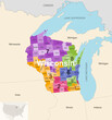 Wisconsin's congressional districts (2013-2023) vector map with neighbouring states and terrotories
 Glowing blue map and digital data concept on bright city background. Info, news and planet concept....
 road map of the US state texas
 Man and woman Asian backpacker trekking planning and looking at map in the forest, Teamwork outdoor...
 Urban vector city map of Bologna, Italy
 Urban vector city map of Mannheim, Germany
 Urban vector city map of Edmonton, Canada
 Urban vector city map of Calgary, Canada
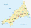 vector road map of cornwall, united kingdom
 map of Tocantins state of Brazil
 Ohio - USA map vector poster flyer
 Colorful political map World continents.
 Piedmont Map. State and district map of Piedmont. Administrative map of Piedmont with district and...
 Detailed map of Washington DC, USA
 Simple outline map of Kenya with capital location
 Businessman touching virtual screen world map of Global logistics network distribution, Container...
 Germany map divided on West and East map, administrative division with names, blue white card paper...
 Seamless displacement or bump map of Fabric. Illustration.
 Mozambique infographic vector illustration complemented with accurate statistical data. Mozambique...
 VietNam Map Black and Red | Territorial Borders | Vietnam | Transparent Isolation | Variations
 Pink color new nepal map illustration on white background
 Creative dark map background with location marks. GPS, innovation and navigation concept. 3D...
 Western Sahara map infographic elements with separate of heading is total areas, Currency, All...
 Administrative vector map of the French region of Brittany with flag
Znaleziono plików: 5228554
 Stylized map of the streets of Singapore made with white lines on black background. Top view. 3d...
 Empire of Brazil the largest borders detailed map with capital and the all world with all sea and...
 Topographic map background geographic line map pattern .panorama view black color wave curve lines...
 World map vector, isolated on black background. Flat Earth, gray map template for web site pattern,...
 Top view map with pin markers showing GPS location of people or friends in the city with direction
 Wisconsin's congressional districts (2013-2023) vector map with neighbouring states and terrotories
 Glowing blue map and digital data concept on bright city background. Info, news and planet concept....
 Man and woman Asian backpacker trekking planning and looking at map in the forest, Teamwork outdoor...
 Piedmont Map. State and district map of Piedmont. Administrative map of Piedmont with district and...
 Businessman touching virtual screen world map of Global logistics network distribution, Container...
 Germany map divided on West and East map, administrative division with names, blue white card paper...
 Mozambique infographic vector illustration complemented with accurate statistical data. Mozambique...
 VietNam Map Black and Red | Territorial Borders | Vietnam | Transparent Isolation | Variations
 Creative dark map background with location marks. GPS, innovation and navigation concept. 3D...


