

Obraz mapy na płótnie, płótno mapy, mapy canvas
FILTRUJ WYNIKI
Orientacja obrazów: wszystkie
pozioma
pionowa
kwadratowa
Rodzaj obrazów: wszystkie
zdjęcie
ilustracja
wektor
Zastosuj
#238888167
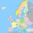 Europe political map | High detail color vector atlas with capitals, cities, towns names, seas,...
#14106621
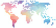
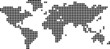 Illustration of a map of the world made up of squares
#373832032
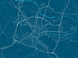 Vector map of Ljubljana. Street map art poster illustration.
#7179921
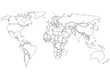 World map black contours only
#727879261
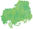 広島県 地図
#723185714
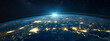 a view of the earth at night from space stock foto in
#689269256
 ビジネス 3d 立体 世界地図背景
#85375005
 carte du monde 19062015
#77523091
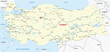 turkey railroad map
#785763798
 Abstract shapes and textures representing a global heat map with cooler tones in regions hit hardest...
#782844208
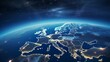
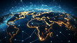 Global network connection. World map composition and global business outline concept. View of earth...
#752423199
 Abstract design with seamless pattern with lines topographic map. geographic mountain relief. retro...
#752407238
 Square shape world map on white background.
#339854678
 Urban vector city map of Balitmore, Maryland, United States of America
#750348099
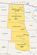 Great Plains Region of the United States, political map. Sometimes simply the Plains, are a broad...
#726611904
 Smartphone with map icon. 3D Map pins, GPS, navigator pin checking points, 3D World Map icon,...
#709245129
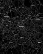 Birmingham UK Map, Detailed Dark Map of Birmingham UK
#83288915
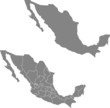 map of Mexico
#243858525
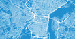 Urban vector city map of Philadelphia, Pennsylvania, United States of America
#191167844
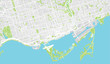 Urban vector city map of Toronto, Canada
#705043397
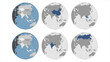 Round Globe Vector Map with Asian Countries highlighted (with Russia), Australia and Major Cities...
#676840600
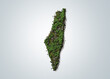 Palestine green 3D map concept isolated on white background.
#672142476
 Europe continent from space. Satellite view
#668704573
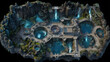 DnD Map Cavern of the Elements' Vast View
#663007095
 Global Celebration: Earth Globe and Presents for Christmas and New Year Concept in 3D Rendering.
#658993851
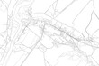 Part of urban plan of a town with river. Vector map.
#651986916
 Black african male geography teacher wearing beard and tie, smile in school classroom and copy space...
#645796113
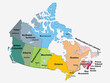 canada political map. map of canada with its provinces. canada map.
#645251567
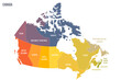 Canada political map of administrative divisions - provinces and territories. Colorful spectrum...
#629688799
 Myanmar map from futuristic concentric blue circles and glowing stars for banner, poster, greeting...
#629354533
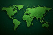 World map green color simple continent outline Generative AI
#621917176
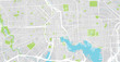
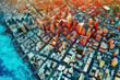 Geospatial GIS product provides visualization of urban areas with road networks created by...
dodaj do ulubionych