

ohio na PCV, PCV ohio, pianka PCV ohio, ohio na płycie PCV
FILTRUJ WYNIKI
Orientacja obrazów: wszystkie
pozioma
pionowa
kwadratowa
Rodzaj obrazów: wszystkie
zdjęcie
ilustracja
wektor
Zastosuj
#341270669
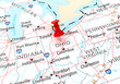
 Ohio Map Black | State Border | United States | US America | Transparent Isolated | Variations
#284841009
 Columbus, Ohio, USA skyline on the river
#358714208
 Ohio US state blank map vector solid black color and outline isolated on white background
#240856344
 Morning Lights
#363073894
 Cleveland Ohio
#102569912
 Ohio Map
#385002495
 Fall foliage in Ohio during the month of October.
#83289957
 map of Ohio
#472857420
 Main Street in Grand Rapids, Ohio, USA
#104279474
 Ohio black map on white background vector
#137537222
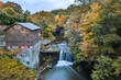 Youngstown Mill
#90140791
 Downtown Columbus Ohio Skyline
#90856494
 Cleveland waterfront with downtown and the Detroit-Superior bridge
#158935902
 State of Ohio flags waving in front of the Statehouse in Columbus, OG.
#398271902
 Aerial view of Oval university campus in Ohio
#187941985
 Ohio Statehouse ceremonial entrance.
#398270570
 State of Ohio. Map of Ohio. United States of America Ohio. State maps. Vector illustration
#282269357
 outline of Ohio map- vector illustration
#405928154
 Aerial panorama of the Ceder Point peninsula at dusk, in Sandusky, Ohio, on the Erie lake.
#379158897
 Ohio Set of Stamps. Travel Stamp. Made In Product. Design Seals Old Style Insignia.
#136806495
 map of the U.S. state of Ohio
#179408040
 Columbus, Ohio, USA
#221230992
 View of downtown Cleveland skyline in Ohio USA
#360703434
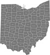
 Ohio county maps
#468349199
 The William McKinley National Memorial for the 25th President of the United States in Canton Ohio.
#154862664
 Chillicothe, Ohio
#421392349
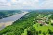
 The Ohio River Valley at Sunrise
#328310695
 map of Ohio
#302266509
 Ohio River Valley
#397109729
 Incredible aerial city skyline panorama photograph of Sandusky, Ohio from the shoreline of the bay...
#217088452
 Flag of the US State of Ohio, detailed vector.
#214955320
 Ohio State Flags
dodaj do ulubionych