

Folia mapy, mapy na folii samoprzylepnej
FILTRUJ WYNIKI
Orientacja obrazów: wszystkie
pozioma
pionowa
kwadratowa
Rodzaj obrazów: wszystkie
zdjęcie
ilustracja
wektor
Zastosuj
#561551012
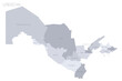 Uzbekistan political map of administrative divisions - regions, autonomous republic of...
#534723601
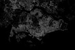 Stylized map of the streets of Singapore made with white lines on black background. Top view. 3d...
#238760054
 Urban vector city map of Derry, Ireland
#530506873
 Folded paper city map
#528707366
 Empire of Brazil the largest borders detailed map with capital and the all world with all sea and...
#764676557
 Topographic map background geographic line map pattern .panorama view black color wave curve lines...
#527104006
 World map vector, isolated on black background. Flat Earth, gray map template for web site pattern,...
#526257424
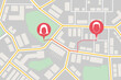 Top view map with pin markers showing GPS location of people or friends in the city with direction
#522529706
 Morocco map and flag. vector
#518769578
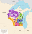 Wisconsin's congressional districts (2013-2023) vector map with neighbouring states and terrotories
#506362956
 Glowing blue map and digital data concept on bright city background. Info, news and planet concept....
#232492085
 Urban vector city map of Bologna, Italy
#231029198
 Urban vector city map of Mannheim, Germany
#191032356
 Urban vector city map of Edmonton, Canada
#190753518
 Urban vector city map of Calgary, Canada
#113285677
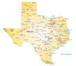 road map of the US state texas
#107239904
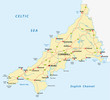 vector road map of cornwall, united kingdom
#592749771
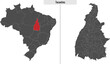 map of Tocantins state of Brazil
#537776293
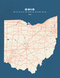 Ohio - USA map vector poster flyer
#521086362
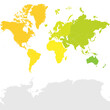 Colorful political map World continents.
#505623465
 Man and woman Asian backpacker trekking planning and looking at map in the forest, Teamwork outdoor...
#504586397
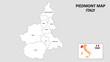 Piedmont Map. State and district map of Piedmont. Administrative map of Piedmont with district and...
#491876555
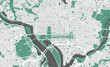 Detailed map of Washington DC, USA
#490272898
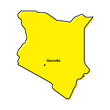 Simple outline map of Kenya with capital location
#485369406
 Businessman touching virtual screen world map of Global logistics network distribution, Container...
#484670248
 Germany map divided on West and East map, administrative division with names, blue white card paper...
#483589049
 Seamless displacement or bump map of Fabric. Illustration.
#483319704
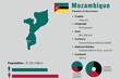 Mozambique infographic vector illustration complemented with accurate statistical data. Mozambique...
#475028488
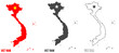 VietNam Map Black and Red | Territorial Borders | Vietnam | Transparent Isolation | Variations
#469544097
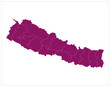 Pink color new nepal map illustration on white background
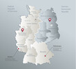
#452488729
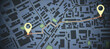 Creative dark map background with location marks. GPS, innovation and navigation concept. 3D...
#450033257
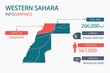 Western Sahara map infographic elements with separate of heading is total areas, Currency, All...
dodaj do ulubionych