

równik na tkaninie, zdjęcie równik na tkaninie, tkanina równik
FILTRUJ WYNIKI
Orientacja obrazów: wszystkie
pozioma
pionowa
kwadratowa
Rodzaj obrazów: wszystkie
zdjęcie
ilustracja
wektor
Zastosuj
#680240563
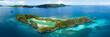 Idyllic Rufas Island, near Penemu in Raja Ampat, is surrounded by healthy corals and open ocean....
#519389841
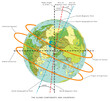
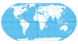 The World, important circles of latitudes and longitudes, blue colored political map. Equator,...
#666459615
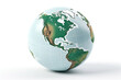
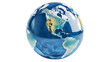 Globe with North America Isolated on Transparent or White Background, PNG
#710782097
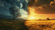 Concept of spring equinox. Day and night, sun and moon meeting together on the split landscape
#767694539
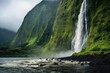 Captivating equator zone: landscapes, waterfalls, and architecture
#634392777
 Planet earth with white isolate on USA view
#564001365
 Productos de la selva del ecuador
#508115998
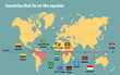 Map of all the countries that lie on the equator
#269511790
 Catedral ciudad de cuenca ecuador
#438483717
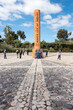
 The equator line
#760762931
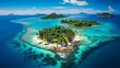 Wild tropical paradise islands in the middle of the blue ocean
#272722761
 El Volcán Cotopaxi custodia la ciudad de Quito, Ecuador.
#63860627
 Vigognes au pieds du volcan Chimborazo
#678999377
 Planet earth equator vector icon
#506812220
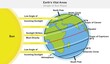 Earth planet vital areas infographic diagram angle of sun ray sunlight radiation solar wind concept...
#485586099
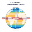 Latitudinal diversity gradient as biodiversity zones on earth outline diagram. Labeled educational...
#437623125
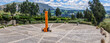
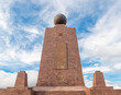 The equator line building monument in Mitad del Mundo (Middle of the World), Quito, Ecuador.
#458132061
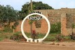 sign of equator Line in Uganda
#150710183
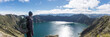
 View of Pululahua Dormant Volcano North of Quito, Pichincha Province, Ecuador
#472772985
 Ecuador, Cayambe true equator site
#668405810
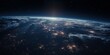 Stunning view of Earth from space featuring blue oceans, swirling clouds, and continents. Ideal for...
#453405910
 The Globe - World Map with continents and countries. Illustration of the earth - geographic pole,...
#219960942
 Randonneur à Quilotoa, Équateur
#325418109
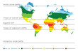 World map with climate zones, equator and tropic lines, arctic and antarctic circle. Vector...
#603766011
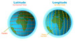
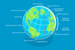 3D Isometric Flat Vector Conceptual Illustration of Latitude And Longitude Diagram, Geographic...
#477227876
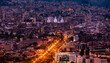 Ciudad de Cuenca-Ecuador en la noche
#747333534
 two chairs banner On the white beach and blue sea
#185893563
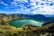 Laguna de Quilotoa, Équateur
#764251176
 A large ship is floating on the ocean near the equator
#745636018
 a hammock between palm trees on a beach
#694520215
 Latitude longitude lines grid, earth mapping . Geographic coordinate system. World prime meridian...
#536430694
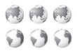 Set of Earth globes focusing on the Asia (top row) and the Atlantic Ocean (bottom row). Carefully...
dodaj do ulubionych