

Zdjęcia na płótno autora asantosg
FILTRUJ WYNIKI
Orientacja obrazów: wszystkie
pozioma
pionowa
kwadratowa
Rodzaj obrazów: wszystkie
zdjęcie
ilustracja
wektor
Zastosuj
#620129598
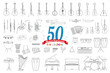 Vector illustration set of 50 musical instruments for coloring in cartoon style isolated on white...
#485829582
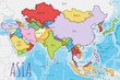 Political Asia Map vector illustration with different colors for each country. Editable and clearly...
#485829815
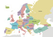
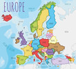 Political Europe Map vector illustration with different colors for each country. Editable and...
#421007323
 Full collection of 501 Traffic or Road signals isolated on white background. Vector illustration...
#580790621
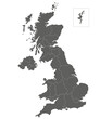 Vector blank map of UK with administrative divisions. Editable and clearly labeled layers.
#712398713
 Political Europe Map vector illustration isolated on white background. Editable and clearly labeled...
#509346018
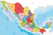 Vector illustrated map of Mexico with regions or states and administrative divisions, and...
#581280274
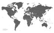
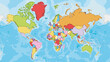
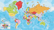 Highly detailed World Map vector illustration with different colors for each country. Editable and...
#509346442
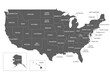 Vector map of USA with states and administrative divisions. Editable and clearly labeled layers.
#492787313
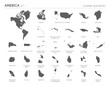 Set of 30 high detailed silhouette maps of American Countries and territories, and map of America...
#492787411
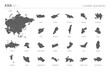
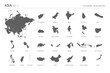 Set of 25 high detailed silhouette maps of Asian Countries and territories, and map of Asia vector...
#492787475
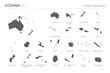 Set of 22 high detailed silhouette maps of Oceanian Countries and territories, and map of Oceania...
#492787403
 Set of 24 high detailed silhouette maps of Asian Countries and territories, and map of Asia vector...
#208374072
 Political blank World Map vector illustration isolated on white background. Editable and clearly...
#671603380
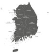
 Vector map of South Korea with provinces, metropolitan cities and administrative divisions, and...
#671603403
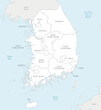
 Vector map of South Korea with provinces, metropolitan cities and administrative divisions. Editable...
#492787452
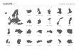 Set of 24 high detailed silhouette maps of European Countries and territories, and map of Europe...
#423561873
 World map grey and white with cities and countries Vector illustration
#492787025
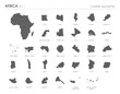
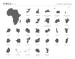 Set of 29 high detailed silhouette maps of African Countries and territories, and map of Africa...
#546878518
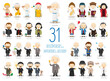 Kids Vector Characters Collection: Set of 31 great Discoverers and Inventors of History in cartoon...
#671603365
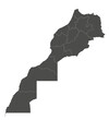 Vector blank map of Morocco with regions and administrative divisions. Editable and clearly labeled...
#485829417
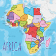 Political Africa Map vector illustration with different colors for each country. Editable and...
#485829902
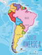 Political South America Map vector illustration with different colors for each country. Editable and...
#485829850
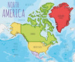 Political North America Map vector illustration with different colors for each country. Editable and...
#492787024
 Set of 30 high detailed silhouette maps of African Countries and territories, and map of Africa...
#485829521
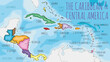 Political Caribbean and Central America Map vector illustration with different colors for each...
#303879414
 Vector illustration of a funny tomato in cartoon style.
#513406527
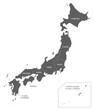 Vector map of Japan with regions and administrative divisions. Editable and clearly labeled layers.
#204514771
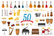 Vector illustration set of 50 musical instruments in cartoon style isolated on white background
#440945985
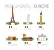 Monuments of Europe in cartoon style Volume 1: Eiffel Tower (France), Pisa Leaning Tower (Italy),...
#489372385
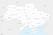 Map of Ukraine with regions, administrative divisions and territories claimed by Russia. Editable...
#581280112
 Highly detailed blank World Map vector illustration with different colors for each country. Editable...
dodaj do ulubionych